-

by
Joe Lombardi
Weather
We're just five days away from the start of spring on Saturday, March 20, but what turned out to be an extremely active winter season has at least one last blast in store, and possibly, two.Tuesday, March 16 will be partly sunny during the day with a high temperature in the upper 30s and wind-chill temps between 10 and 20 degrees.Clouds will increase in the afternoon as a storm system ...
-

by
Joe Lombardi
Weather
Areas in which accumulating snowfall is expected have been identified for a quick-moving new storm system that will sweep through the region.The time frame for the storm is from early Monday afternoon into early Monday evening, Feb. 22.An inch or so of snowfall is possible north of I-287 in New York and the Merritt Parkway in Connecticut and Massachusetts before a changeover to rain. ...
-

by
Jerry DeMarco
Breaking News
A rapper from Bergen County who was busted on gun charges following a shooting at a Teaneck nightclub trashed the home of a Mahwah couple, a lawsuit filed by their insurance company says.Artist Julius Dubose – better known as A Boogie Wit da Hoodie – clogged and overflowed toilets, cut up carpeting and replaced it with mismatched pieces, among other acts of destruction, when he leased ...
-

by
Joe Lombardi
Weather
A stretch of dry, seasonable weather will be coming to an end as a storm system bringing rain to most of the region and snowfall to interior locations moves through the Northeast.The time frame for the storm is Friday night, Jan. 15 into Saturday, Jan. 16.There will be variable cloudiness with temperatures a bit above normal in the days leading up to the storm, with the high temperature ...
-

by
Cecilia Levine
Weather
A newly-released forecast called for two rounds of precipitation Sunday, with winter weather advisories issued for parts of North Jersey and Eastern Pennsylvania.The first was snow, and it was making its way across North Jersey and Southeastern Pennsylvania as of 8:15 a.m. Sunday, the National Weather Service said.Between two and four inches of snow and sleet were possible in North ...
-

by
Kristin Palpini
Weather
Snow is on the way for today, according to the most recent forecast by the National Weather Service.It won’t add up to much, but meteorologists are predicting light snow in the region today, Wednesday, Dec. 30.The snow will be heaviest in Central Massachusetts and the Northern Berkshires with the Worcester, Fitchburg, Pittsfield, and North Adams areas expected to receive an inch of ...
-

by
Joe Lombardi
Weather
The final days of 2020, which will go down in the history books as a year like no other (to put it mildly), are expected to be relatively uneventful weather-wise, with a stretch of dry days with seasonably cold temperatures.But, perhaps fittingly, 2020 may have one last surprise in store.That's because a potentially powerful storm system is expected to sweep through the region New ...
-

by
Kristin Palpini
Breaking News
As the intensity of a Christmas storm increases, meteorologists are predicting local travel conditions may be difficult on Christmas Eve.The Thursday, Dec. 24, forecast calls for a 100 percent chance of rain in the evening and it will be heavy at times. Wind gusts are expected to reach 40 mph, according to the National Weather Service.The wet weather comes courtesy of a powerful ...
-
by
Joe Lombardi
Weather
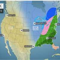
The National Weather Service has issued a Hazardous Weather Outlook statement for a powerful system that will sweep through the area on Christmas Eve, bringing drenching rain, thunderstorms, and damaging winds that could cause power outages.The time frame for the storm is Thursday night, Dec. 24 into Friday morning, Dec. 25."The combination of lingering snowpack and heavy rain may bring ...
-

by
Kristin Palpini
Weather
Christmas is more likely to look gray than white this year with rain predicted starting on Christmas Eve.The weather in Central and Western Massachusetts in the week leading up to Christmas is forecast to be warm, clear, wet, then cool. Today, Monday, Dec. 21, will start off with patchy freezing fog with a love of 27 degrees, according to the National Weather Service.Tuesday, Dec. 22, ...
-

by
Joe Lombardi
Weather
It's beginning to look a lot like we may be getting a new round of snowfall on Christmas.Long-range forecast models now show the potential for a storm powered by Arctic air bringing snow, sleet, and rain expected to develop on Christmas Eve, Thursday, Dec. 24, and continue into Christmas Day, Friday, Dec. 25."The snow area is going to be smaller, and at this point, we’re not going to be ...
-

by
Joe Lombardi
Weather
A stretch of dry weather will end with a rainy start to the weekend followed by two separate chances for snow, including a possible midweek Nor'easter.Here's the day-by-day outlook.Rain will arrive Saturday morning, Dec. 12, with patchy fog at times. The high temperature will be in the low 50s. Rain will taper off by late Saturday afternoon, followed by a chance of showers through the ...


